
EmergencyLocate Supports JESIP’s M/ETHANE
EmergencyLocate Supports JESIP’s M/ETHANE
Nick Sutton, EmergencyLocate Founder and Director
JESIP and EmergencyLocate have partnered to bring innovative enhancements to the JESIP app when viewing and navigating to an incident location. We are excited to support our commanders and responders with EmergencyLocate’s SAR Deploy solution which helps to pass location data from the JESIP app to a range of mapping and navigation apps without the need to further input any coordinates or address information. The intent behind this integration is to speed up deployment times and ensure everyone arrives in the same location.
EmergencyLocate’s Founder and Director, Nick Sutton, said: “This is an exciting partnership piece of work that has been undertaken between EmergencyLocate and the team at JESIP and will make our SAR Deploy solution available across the UK Emergency Services, via the JESIP app.”
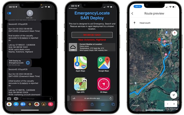
Nick continued “SAR Deploy was designed to fill the ‘navigation gap’ between leaving your vehicle and arriving at a remote location, that may be some distance from the nearest road! From the JESIP app, a responder needs only two taps on the screen to view the incident location with OS Mapping detail or 3D satellite views or begin navigation.”
“SAR Deploy has options built in for sharing the link by either using the functionality on your device, such as messaging, Bluetooth etc, or by having nearby responders scan a QR code. This means everyone can be sure of arriving at the same place, which is always helpful in a major incident response!”
SAR Deploy is part of a wider suite of solutions that support emergency, search and rescue organisations. Our cutting-edge web application allows rapid location of mobile devices, supported by two-way text messaging with integrated AI-powered translation tools to give dispatch teams the very best chance of being able to communicate with, and locate, a person in distress in even the toughest of circumstances. EmergencyLocate’s technology means we can locate people without needing them to speak, at all!
Our 3D satellite mapping provides stunning clarity and improves dispatch-decision making to ensure teams aren’t only considering where they need to go, but also how best to get there.
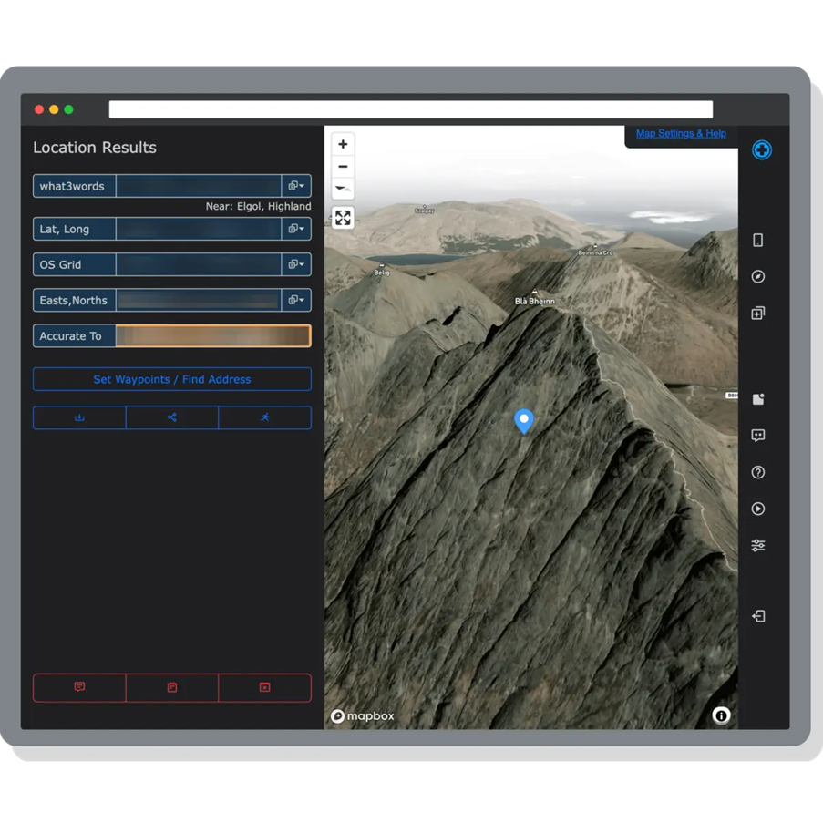
We provide a range of location formats, localised to your country as well as the nearest address to any given point, with intelligent options for you to easily share that information with CAD. For those away from a computer we developed our Text Message Interface (TMI) which brings the power of EmergencyLocate into the field. Responders, Mountain Rescue Team leaders and others can communicate directly with our platform over text message to locate a device, convert coordinate information, find the nearest address, or direct others to a specific location.
Recently our TMI has proven itself as a control room business continuity and disaster recovery tool. As location information becomes all the more important, when you are suddenly without your usual systems it’s loss is all the more significant. Whether a planned upgrade, network outage or power loss disrupts your CAD availability, if you can send a text message then you can still access our solutions!
If you would like to learn more about EmergencyLocate and how we are helping to empower emergency, search and rescue teams and ensure an efficient emergency response, please don’t hesitate to reach out to our team via the website at https://www.emergencylocate.co.uk